Starting our ascent up the headwall felt reasonably safe, as the angle wasn’t too steep and the granite had enough texture and ledges that it was more or less a low-incline ladder-esque climb. To our understanding, this was a classic route up Huntington Ravine that many hikers attempt, especially in clear, dry weather. The low incline inside corner gave a false illusion of safety in the lower half of the ascent, cloaking the rest of the granite slab.
We focused on running through the bottom half of the headwall. This focus made us unaware of how high we were getting. Eventually, we made it about halfway to the top of the ravine. There, a decent-sized crack ran horizontally along the rock. We deemed this crack a good rest spot. None of us had really looked below to gauge our progress. Then, I noticed a bolt with a quickdraw in the vertical slab 10 feet to my left.
We were not on The Pinnacle, because The Pinnacle is the 5.8 climb to our left. We were off-trail, 200 feet off the ground, clinging to the side of a granite slab with no idea where to go.
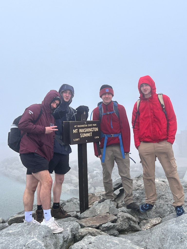
The plan was straightforward: A four-person team (me and 3 others) headed to Huntington Ravine to climb The Pinnacle. We chose a day (September 11, 2025) where conditions were manageable in anticipation that the hike would take longer than we thought. The route – at least on paper – was well within reach.
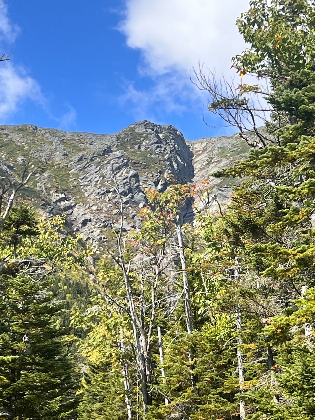
The approach into the ravine reinforced confidence and morale for the day. The walls around us rose sharply into the sky; nothing suggested that the day would deviate from our plan.

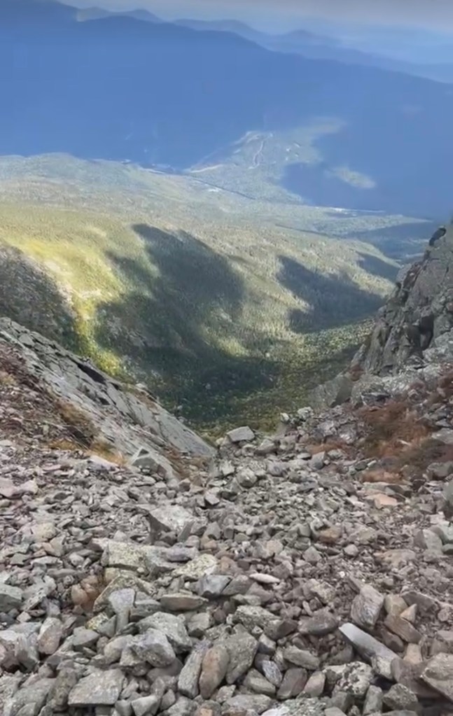
From the base of the headwall, the route appeared obvious. A steep inside corner that was a direct line to the top of the ravine that matched the route we had planned.
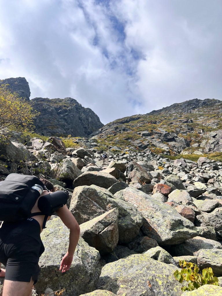
There was little hesitation as we saw the obvious route from about a half mile away. By this point, we were about 4 miles into the hike, starting from the Huntington Ravine trailhead in the parking lot at the AMC Pinkham Notch Visitor Center. From the visitor center, you can access trailheads that reach Tuckerman’s Ravine, Huntington Ravine, Lions Head, and the Alpine Gardens, all of which lead to the summit of Washington.
Approaching the base of the headwall, we spotted the line we would take and started the climb.
The first moves from the base were consistent with expectations – steep, but manageable for our ability. The rock presented smooth scrambling, which felt safe and on route.
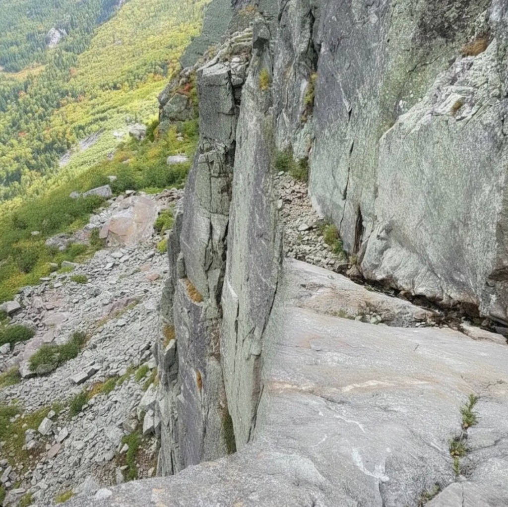
As the climb continued, subtle changes started emerging. The face began to steepen. Features became less defined. We became more careful of our hand and foot placements. Any attempt at turning back would mean down-climbing the 150 or so feet we had just come up. It was apparent that the route was wrong, we overzealously continued up regardless.
Around halfway up the 700-foot headwall of sheer granite, there was a sort of “thank god” ledge where we took a breather and assessed the route. This is when I looked to the left at the vertical wall and noticed a bolt with a quickdraw attached.
I realized that what we were climbing was not The Pinnacle. It was the vertical 5.8 trad climb to our left. We were climbing off the trail. Our route was completely wrong, and now we’re hundreds of feet up without a rope or gear, strung out on what was at the beginning a class 3 scramble turned Alex Honald style free solo.
We slowed down our climbing, becoming much more meticulous with our movements. As a group, we were communicating the best route up the now steep and exposed face, worrying about myself and also the people I was hiking with. Any fall would be a fatal plummet down the face so deliberate movements were necessary.
Fortunately, 3 of us have experience rock climbing, for the non-rock climber in the group, panic and fear set in. He became shaky with his movements, only moving when told the correct beta after the three of us had climbed a section.
Communication became more deliberate. Each movement mattered, and spacing between climbers increased as everyone worked through the same section individually.
Decisions were no longer about route choice; they were about execution.
Eventually, the terrain eased after the exposed top out.
What started as a straightforward scramble up Huntington Ravine turned into a much more serious climb where a slip of a foot could have meant serious injury or death for any one of us. Still, from the top of the ravine, the route looks obvious.
Route-finding errors in the mountains are common and can lead to deadly situations. I was ignorant, thinking that type of thing would never happen to me, as I have been in these mountains for years and thought I knew my way around the range. Misjudgments can quickly escalate, especially when paired with steep rocky terrain and little to no protection. This experience has made me much more careful with route finding and brought a reality that I thought was never going to happen.
Since The Pinnacle, I have been more accurate and intentional with the routes I take in the mountains, mapping out exactly what I intend to do before attempting. It helps tremendously to share the route/plan for the day with everyone included. Judgement and discretion are important skills when hiking and climbing; having multiple people’s judgment on a situation can occasionally save lives, or at the very least, avoid a shitty situation.